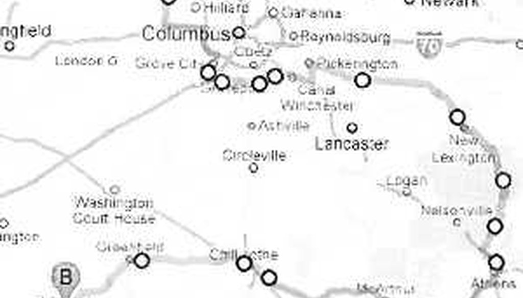


Ohio Democratic Party Chairman Chris Redfern says driving from one end of Ohio's newly drawn 15th Congressional District to the other would be like driving from Columbus to Niagara Falls.
Democratic Party chief Chris Redfern gets paid to take shots at Republicans.
On Sept.15, Redfern had a juicy new target for his barbs -- a new congressional map that Republicans had rolled out the day before. It showed several sprawling districts winding through multiple counties to create solid GOP majorities.
Prepared by Republicans staffers, the congressional map redrew Ohio’s 18 congressional districts into 16 districts — 12 Republican and four Democratic districts. It was attacked by Redfern (and other Democrats) who said the serpentine districts were mapped out purely for GOP partisan advantage.
As he mocked the lines drawn by Republicans, Redfern highlighted the district that many independent observers found to be the clearest example of gerrymandering — the 15th Congressional District, which winds through portions of 13 counties and has a circumference of 934 miles.
Now represented by Republican Steve Stivers, the district is shaped like the open jaws of a crocodile or a "reverse Pac-man," in Redfern’s words.
"To drive from northern Union County to Athens to Hillsboro without leaving Steve’s district you’d find yourself on the road as long as it would take to drive from Columbus to Niagara Falls," Redfern told reporters at his news conference.
Sure, the district is a sprawling one — but a greater drive time than to the Canadian border? PolitiFact Ohio gassed up the Ford Factfinder and see where the facts met the road.
Democratic Party spokesman Seth Bringman shared the Google mapping he did to back up Redfern’s assertion.
He forwarded a route which began in Essex in northern Union County winding through Madison, Franklin, Fairfield, and Perry Counties as it headed east. Heading due south into Athens County, the route then swung westward traveling though Vinton and Ross counties to end in Hillsboro, the county seat of Highland County.
Google maps spit out a total distance of 259 miles and said it would take nearly 6 hours — 5 hours and 58 minutes to traverse it. Meanwhile, Columbus to Niagara Falls, N.Y., is 349 miles -- mostly via freeway -- and a traveling time of six hours and one minute, according to Google Maps.
PolitiFact Ohio scrutinized the Democratic route and it does follow the contours of Stivers’ new district. However, the Democrats did fudge one tiny part of their route — they took state routes through southern Franklin County that are near, but not actually in Stivers’ district.
But they had to. Or you’d have to swim.
"It’s so skinny at the southern edge of Franklin County that no road passes through it," The Columbus Dispatch reported Sept. 18, 2011. "He would have to swim across the Scioto River near the Southerly Wastewater Treatment Plant to travel from one end of his district to the other."
Bringman acknowledged that the map was more of "an interpretation" of driving through the proposed district than actually doing it.
"To navigate the Southern end of Franklin County in the proposed 15th District, one would need to drive off-road for about 5 km between Lynnbrook and Lockbourne and ford the Scioto River Oregon Trail-style," he wrote in an e-mail. "Depending on the vehicle being used, this could add some time to the trip. After passing Lockbourne, the driver may need to borrow a runway at Rickenbacker International Airport, assuming FAA approval."
Additionally, it bears pointing out that the Democratic route is an attempt to get around Stivers district by staying wholly in the district at all times — it’s not how someone would actually travel to get from one point to another.
For example, Stivers district includes only portions of U.S. 33, so you can’t use it to travel from Columbus to Athens even though it’s a direct link between the two cities.
"He will be taking direct routes not only traveling within the lines of his district," said Courtney Whetstone, a staffer with Stivers’ Columbus congressional office. "There isn’t any part of his district farther than an hour and a half from his house."
Redfern’s statement does include the phrase "without leaving Stivers’ district" but the twists and turns of the road embodied in that statement are not made clear.
So after all this ramblin’ through Ohio, where do we end up?
Google maps estimates Redfern’s route plotted through the "reverse Pac-man" district would take six hours to drive and that matches the estimated drive time from Columbus to Niagara Falls.
The claim has to take a detour, though, because it’s not possible to drive through the new Ohio 15th in southern Franklin County. But then again, we can award points for context because the claim supports Redfern’s larger point -- that the boundaries for this sprawling district were drawn to achieve a political purpose.
Lastly, it needs to be said that Redfern’s route is not the way that Stivers or anyone would travel from one part of the district to another. Rather, they would choose a direct route that crosses district boundaries and would be a much shorter drive. That’s a point that provides clarification.
On the Truth-O-Meter, we rate Redfern’s claim Mostly True.
Ohio Democratic Party Chairman Chris Redfern, statement about the redrawn 15th Congressional District, video posted to YouTube on Sept. 15, 2011
E-mails and interview with Ohio Democratic Party spokesman Seth Bringman. Sept. 15, 16 and 23, 2011
Interview with Courtney Whetstone, Columbus office staffer for Rep. Steve Stivers, Sept. 23, 2011
The Columbus Dispatch, "A Stronger Hand: Reshuffle of seats likely to benefit area, experts say" Sept. 18, 2011
In a world of wild talk and fake news, help us stand up for the facts.
